
Narva as an Early Warning Frontier for Drone Incursions into Estonia
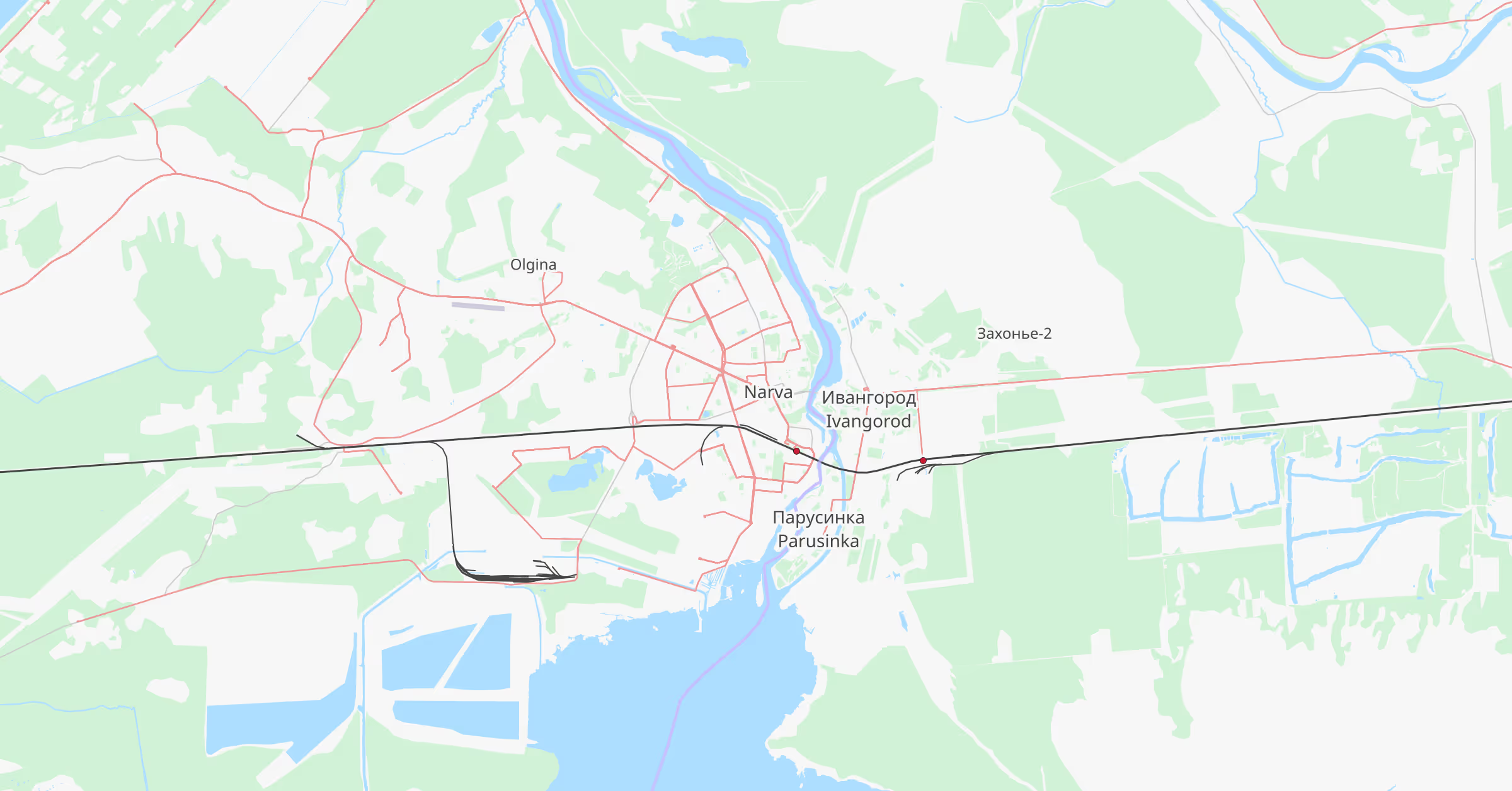
The Estonian border city of Narva occupies one of the most strategically exposed locations in Europe. Separated from Russia only by the Narva River, the city faces the Russian town of Ivangorod at a distance that is, in places, little more than a few hundred metres. As the easternmost urban edge of both the European Union and NATO, Narva represents one of the most visible geographic boundaries between the West and Russia. While security discussions about Narva have historically focused on the risk of conventional or hybrid land incursions, the rapid evolution of unmanned systems introduces another dimension of vulnerability: small drones capable of crossing the border and travelling deeper into Estonian territory.
Recent conflicts have demonstrated that the most effective unmanned platforms are often small, inexpensive drones that can be produced rapidly and deployed in significant numbers. These systems have low radar signatures, limited acoustic footprints, and can be launched from dispersed or improvised locations. For a border environment such as Narva, this means that drones launched from Russian territory could cross the river in seconds and then continue westward before traditional defences are able to detect or respond to them.
Narva is not the only location where drones could enter Estonia. The Estonian–Russian border extends across forests, lakes, and sparsely populated areas that could also serve as ingress routes for unmanned aircraft. Nevertheless, Narva remains uniquely significant. It sits directly opposite Russian territory in a dense urban environment and lies on the most direct corridor toward key infrastructure in northeastern Estonia. It is therefore highly plausible that any sustained drone reconnaissance activity targeting Estonia — whether for surveillance, intelligence gathering, or in preparation for a wider conflict — would include flights crossing near Narva.
Once inside Estonian airspace, the objective of such drones would most likely be intelligence collection rather than immediate attack. One particularly relevant corridor is the E20 route that connects Narva with Tallinn. This highway forms one of Estonia’s principal east–west transport routes and carries both civilian traffic and military logistics between the border region and the capital. A drone travelling along or near this axis could gather valuable intelligence on infrastructure, transport flows, and potential logistical choke points. Additional areas of interest might include military facilities, communications infrastructure, logistics depots, and energy installations located deeper within Estonia.
The preference for small drones in such operations is not simply a matter of stealth. It is also shaped by engineering constraints. Compact unmanned platforms operate under strict limitations in battery capacity, payload weight, and available internal space. Every additional gram of equipment reduces range and endurance, while the power available for onboard electronics is tightly constrained. These factors influence the communications systems that can realistically be carried by the aircraft.
Traditional long-range radio links or mesh networking systems often require relatively large antennas, higher transmission power, and heavier hardware. While lightweight versions of such systems do exist, the payload and power constraints of small drones can make these approaches less attractive. By contrast, modern cellular modules designed for commercial devices are extremely compact, lightweight, and energy efficient. Contemporary 4G LTE and 5G modems can weigh only a handful of grams while providing high-bandwidth connectivity suitable for telemetry and video transmission. For drone designers operating under tight weight and power budgets, these characteristics can make cellular connectivity an appealing option where network coverage is available.
A drone equipped with a cellular modem can attach to a mobile network once it enters coverage. From that point onward, the aircraft can transmit telemetry, imagery, or video data back to operators located far beyond the immediate area of operations. In effect, the drone leverages existing telecommunications infrastructure as a communications backbone. This removes the need for specialised long-range radio links and allows data to be transmitted over distances well beyond traditional line-of-sight control.
Before relying on mobile networks for operational communications, an adversary would likely seek to understand the radio environment inside Estonia. Reconnaissance drones could plausibly be used to characterise mobile network coverage near and beyond the border region. Such platforms could measure signal strength, identify which operators provide the strongest coverage, and observe how connectivity behaves at different altitudes or locations. The resulting information could help identify flight corridors where reliable connectivity may be maintained during deeper drone operations into Estonian territory.
In this context, Narva itself could serve as an important early warning zone for drone activity. Any drone entering Estonia in this area and relying on cellular connectivity would likely encounter Estonian network coverage almost immediately. When the device attaches to the network, it generates signalling activity similar to that produced by ordinary mobile devices. However, the behaviour of an airborne device often differs from that of a smartphone carried by a person or vehicle on the ground. Rapid movement across multiple cells, unusual handover sequences, and devices appearing suddenly near border areas can produce patterns that are inconsistent with typical terrestrial mobility.
By analysing these signalling patterns, mobile network operators can gain visibility into anomalous device behaviour occurring within their networks. Advanced signalling analytics platforms developed by UK-based Melrose Networks are designed to ingest and analyse control-plane signalling data from core network interfaces such as S1AP and NGAP. Through the analysis of attachment behaviour, mobility patterns, and signalling sequences, such platforms can help identify activity that differs from normal subscriber usage. This type of analysis does not replace radar, RF detection systems, or other counter-UAS measures, but it can provide an additional layer of situational awareness across large geographic areas.
Seen in this light, Narva represents more than a geographic boundary. It is also a technological frontier where telecommunications infrastructure, unmanned systems, and national security intersect. While drones could enter Estonia along many sections of the border, Narva is likely to remain one of the most strategically significant corridors due to its proximity to Russian territory and its direct route toward key transport and military infrastructure. Monitoring mobile network behaviour in this region could therefore provide valuable early indicators of drone activity that might otherwise remain undetected until those systems are much deeper inside the country.